This historic pioneer
cemetery is the fourth largest historic cemetery in Clackamas
County. It was established between Wilsonville and Sherwood in the 1850's during the nation-wide
rural cemetery movement, sometimes also known as the cemetery-on-the-hill movement that sited cemeteries in view
locations outside of towns rather than in church yards or
 other
urban locations. The movement was especially pronounced in the
West where many settlers were not affiliated with an established
church. Part of the philosophy behind the movement was the
belief that the soul could better find its way to God, if the final
resting place was in a natural setting, removed from the earthly
trappings of human development. The cemetery was called
Pleasant Hill Cemetery, named for the Pleasant Hill census tract
that covered much of the Wilsonville-Sherwood area for the 1850 and 1860
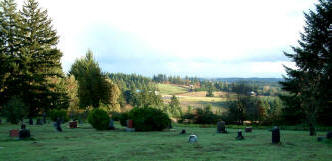
census. It was also known as Hood View Cemetery since at one
time it had a fabulous view of Mt. Hood, that has since been lost to
tree growth. Until 1860
this area west of Wilsonville was part of Yamhill County. Documents,
such as obituaries, marriage certificates, and census data thru 1860
will refer to this area as Yamhill County. After 1860 it became part
of Clackamas County and remains so today. other
urban locations. The movement was especially pronounced in the
West where many settlers were not affiliated with an established
church. Part of the philosophy behind the movement was the
belief that the soul could better find its way to God, if the final
resting place was in a natural setting, removed from the earthly
trappings of human development. The cemetery was called
Pleasant Hill Cemetery, named for the Pleasant Hill census tract
that covered much of the Wilsonville-Sherwood area for the 1850 and 1860
census. It was also known as Hood View Cemetery since at one
time it had a fabulous view of Mt. Hood, that has since been lost to
tree growth. Until 1860
this area west of Wilsonville was part of Yamhill County. Documents,
such as obituaries, marriage certificates, and census data thru 1860
will refer to this area as Yamhill County. After 1860 it became part
of Clackamas County and remains so today.
The oldest death date on
a monument in
the cemetery is 1851 for Thomas Tuckness, an infant of 5 months who
died in Missouri before his family emigrated in 1853. He is
likely buried in Missouri but his name is on the monument with his siblings, Sarah M. Tuckness, who died in 1865
at 2 years of age and W. J. Tuckness who died in 1866 at the age of
10 years. It is likely that this monument was not produced
until 1865 or 1866 or even later. The exact age of the monuments is
hard to determine because they may have been produced, or original
markers replaced, at dates much later than the actual burial date.
The oldest recorded burial here is for Mary Elizabeth Baker, who
died here in 1856 at 4 years of age, but there is no monument for
her. Among the oldest known monuments
in the cemetery is that of Mary E. Short who died in 1862 at 2 years
of age. Most of the pre-1900 monuments are marble on a
sandstone base, although some sandstone bases have deteriorated and
been replaced with concrete. After the turn of the century, cutting
technology improved enough to work with the much harder and more
durable granite, which tends to dominate after 1910. About the
same time, concrete or granite replaced sandstone as the primary choice for
bases. Other
materials used for monuments include zinc, bronze, concrete, wood, and a
black glass resin plate.
The cemetery was
part of the Donation Land Claim of Moses Matthew Baker whose stone
says it was donated in 1886. By that time it had been in use
as a family and community cemetery for thirty years. In 1980
the cemetery name was changed to Pleasant View Cemetery after the
discovery of a second Oregon pioneer cemetery named Pleasant Hill.
The wrought iron gates and fencing were added in the 1980's after an
especially damaging attack by vandals who toppled most of the large
stones, some of which were not re-set until the restoration work in 2008
and 2014.
Pleasant View Cemetery
is an active historic cemetery, continuing to serve families from the
Wilsonville/Sherwood area. There are approximately 2300
burials of record, making it one of Oregon's larger pioneer
cemeteries. At least 250 recorded graves are unmarked.
Some may have never received a monument, wooden markers may have
deteriorated, stone markers may have fallen and been covered
by sod, and others may have been removed by vandals. Fortunately we
have the original cemetery ledgers which have been used to locate,
as closely as possible, everyone who is recorded in the ledgers.
Unfortunately, not everyone who was buried here made it into the
ledgers. Check the block maps to see everyone the ledgers
indicate is in the family plot, even if they have no marker.
If you don't find someone you believe should be here, it is possible
that they are one of those with no marker, who also were missed in
the ledgers. If you have evidence - like an obituary or death
certificate - that indicates they are probably here, please let me know and I
will try to rectify the records.

|